Okanagan Drone-assisted Viticulture Gains Ground
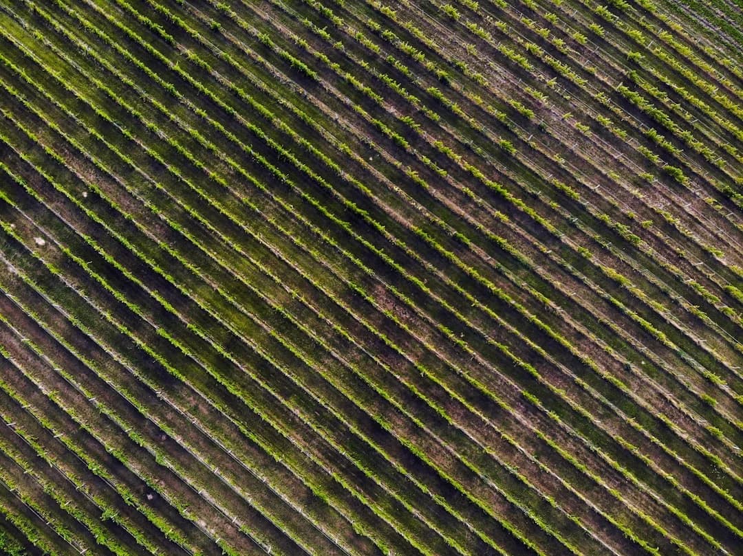
Photo by Michael Cragg on Unsplash
The Okanagan is quietly reshaping its vineyard management playbook through Okanagan drone-assisted viticulture, a data-driven approach that blends high-resolution imagery with agronomic expertise. As of June 20, 2026, multiple industry sources indicate that growers across the valley are expanding the use of unmanned aerial systems to monitor vine vigor, detect water stress, and guide precision irrigation and canopy management. This shift matters for a wine region that has long prioritized terroir, climate resilience, and sustainable farming practices. By capturing detailed field-level data from above, Okanagan vintners and service providers are turning drone-derived insights into actionable decisions that influence water use, fruit quality, and ultimately the bottom line of BC’s wine economy. The trend aligns with a broader Canadian and global move toward precision viticulture, where remote sensing and data analytics are used to manage intra-vineyard variability rather than treating an entire block as a uniform unit. (bcwgc.org)
In practical terms, Okanagan drone-assisted viticulture means pilots and agronomists are now routinely mapping vineyards with multispectral sensors, calculating vegetation indices such as NDVI and NDRE, and layering thermal data to infer water stress. These tools enable growers to identify hotspots of vigor or drought stress within a single block, allowing irrigation and nutrient inputs to be targeted with spatial precision. Industry observers note that this capability is especially valuable in a region where irrigation accounts for a significant share of production costs and where climate variability can create uneven water demands across slopes and soils. The work is supported by ongoing research and demonstration projects in British Columbia that investigate how UAV imagery relates to vine health, fruit composition, and irrigation efficiency. (bcwgc.org)
Opening
Okanagan drone-assisted viticulture is emerging as a practical pathway to more efficient water use and more uniform grape quality, driven by private-service providers and academic research alike. In Kelowna, Oliver, and the Similkameen, several aerial imaging firms and vineyard-management specialists are actively marketing NDVI and thermal imaging services tailored to wine grapes. These offerings include high-resolution multispectral mapping, canopy and soil moisture assessments, and subsequent decision-support for irrigation scheduling and canopy pruning. The activity is not happening in isolation; it reflects a broader movement in the BC wine sector toward remote sensing for disease scouting, stress detection, and site-specific management. As a reporting baseline, BC Wine Grape Council’s ongoing work on UAV imaging and precision viticulture has highlighted both the potential benefits and the practical constraints of deploying drone-based tools at scale in British Columbia's climate and regulatory environment. (bcwgc.org)
The technology is rapidly maturing, but adoption remains measured. Industry participants emphasize that drone imaging is a complement to, not a replacement for, on-the-ground scouting, irrigation infrastructure, and expert viticulture practices. The BC context includes regulatory realities around drone use in agriculture, particularly for spraying activities. While mapping and surveillance with drones are common and increasingly routine, pesticide application from drones is subject to regulatory review, and to-date there are no universal approvals for aerial-application of crop protection products in Canada. This regulatory nuance has helped shape how Okanagan growers implement drone-assisted strategies, prioritizing imaging, scouting, and data-driven inputs over aerial spraying until policy and approval pathways are clarified. (croplife.ca)
Section 1: What Happened
Announcement Details
In the Okanagan, the integration of drone-assisted viticulture into mainstream practice has been propelled by a mix of service providers, research institutions, and grower associations. For example, firms offering multispectral and LiDAR-based vineyard analyses advertise capabilities to produce NDVI, NDRE, and other vegIndex maps, enabling site-specific management decisions. Kelowna-based firms and nearby providers emphasize that such imaging supports precise irrigation planning, frost and drought stress detection, and early disease scouting. Notable players include firms that market crop-health mapping, 3D vineyard reconstructions, and actionable insights derived from high-resolution aerial data. These capabilities are being used to optimize irrigation timing, reduce water waste, and inform canopy management strategies that influence sun exposure and fruit composition. The practical outcomes cited by service providers include faster stress detection, more targeted input applications, and improved record-keeping for compliance and sustainability reporting. (swiftaerialsurveys.ca)
In parallel, BC-based research organizations and government-linked programs are validating and refining the use of UAV data for viticulture. The British Columbia Wine Grape Council (BCWGC) has published and presented work on disease detection, irrigation optimization, and spatial characterization of terroir using GIS and UAV imaging. This body of work explicitly discusses how remote sensing can illuminate intra-vineyard variability and guide management decisions that improve water use efficiency and fruit quality. The emphasis is on evidence-based practices, with researchers comparing UAV-derived indices to vine vigor, canopy size, nutritional status, and berry composition across a range of varieties grown in the Okanagan Valley. These studies provide the scientific backbone for the practical drone services now being offered to growers in the region. (bcwgc.org)
Timeline and Key Facts
-
January 16, 2025: The BCWGC RD Committee met to discuss UAV imaging, remote sensing, and the potential applications of multispectral data for precision viticulture in the Okanagan. During the session, committee members highlighted the ways in which NDVI and related indices can be used to monitor vigor, stress, and nutrient status across blocks of vines, enabling more precise management decisions. This meeting underscored a policy and research direction that would shape adoption in the following years. (bcwgc.org)
-
2025–2026: A wave of private-sector activity in the Okanagan expanded the availability of drone-based services tailored to wine grape production. Service providers emphasize imaging with RGB and multispectral sensors, with outputs that support early stress detection, targeted irrigation, and canopy optimization. Examples of regional players include companies offering multispectral imaging for agricultural fields, 3D vineyard mapping, and high-precision field surveillance. These offerings are complemented by AI-assisted processing to translate imagery into practical agronomic recommendations. (jkas.ca)
-
2026: Growing interest in water-use efficiency and climate-adaptive viticulture has intensified collaboration among growers, consultants, and researchers. BCWGC continues to publish and disseminate findings related to UAV-based monitoring and its implications for irrigation, soil health, and grape quality. Independent research published in reputable venues reinforces the value of NDVI/NDRE-based assessments for estimating vine vigor and water stress, while also noting the need for careful interpretation of indices in different phenological stages and varietal contexts. (pmc.ncbi.nlm.nih.gov)
-
Regulatory note: While imaging and monitoring via drones are commonplace, the use of drones for spraying pesticides remains regulated, with no blanket approval for in-crop pesticide application in Canada as of mid-2025. Stakeholders acknowledge that drone-enabled precision imagery remains the most mature and widely accepted use case in the near term. This regulatory landscape informs how growers deploy drone assets and what services they contract locally. (croplife.ca)
Tech & Partners
The core technology behind Okanagan drone-assisted viticulture includes multispectral sensors capturing red, green, blue, near-infrared, and sometimes thermal bands, which feed into vegetation indices like NDVI and NDRE. These indices correlate with chlorophyll content, canopy density, and water status, enabling the identification of stressed areas before visible symptoms appear. In practice, this translates into more precise irrigation—reducing net water use where crops are not stressed and allocating more water where monitoring indicates deficit stress or high evapotranspiration. Vendors emphasize the ability to layer additional data streams, such as LiDAR for precise terrain models or 3D canopy reconstructions, to improve irrigation scheduling and pruning decisions. In some cases, firms pair drone imagery with field scouting and agronomic expertise to generate comprehensive management plans, including crop-nutrition strategies aligned with soil analyses. (swiftaerialsurveys.ca)
Section 2: Why It Matters
Water Management and Irrigation Optimization
Water is a defining constraint for wine grape production in the Okanagan, where irrigation is essential and climate variability can drive uneven soil moisture and vine water status across slopes and soils. The BCWGC and partner projects have highlighted how precise irrigation can be informed by UAV-derived data. The overarching goal is to reduce water use while maintaining or improving grape quality. A key question is how to calibrate irrigation to vine demand, early-season water status, and fruit development stages. UAV-based remote sensing supports this by revealing spatial variability in vine vigor and canopy temperature, which can be translated into variable-rate irrigation prescriptions. The BCWGC “Fine-Tuning Irrigation Rates and Frequency” project notes that irrigated landscapes in the Okanagan require careful management, and that strategic water deficits at certain growth stages can even enhance certain sensory attributes in grapes and wine. While the project emphasizes the agronomic rationale, drone-derived imagery provides the spatial data necessary to implement site-specific irrigation decisions with confidence. (bcwgc.org)
Remote-sensing-driven water management is supported by broader research indicating that combining high-resolution thermal, multispectral, and 3D imagery yields robust indicators of water stress and soil–plant interactions. Studies across North America and Europe have demonstrated that NDVI and thermal data can be integrated to predict vine water status and to inform irrigation scheduling. A 2020–2024 body of literature demonstrates the utility of UAV-based metrics for estimating water stress proxies and guiding irrigation decisions in vineyards, with evidence that such data can improve water-use efficiency when paired with agronomic models. While much of this work originates outside BC, its application to Okanagan conditions is a focal point for researchers and industry groups seeking to tailor precision irrigation to local soils, climate, and varieties. (pmc.ncbi.nlm.nih.gov)
Quotable insight from industry observers reinforces the practical impact: UAV-based scouting can rapidly identify stress zones, enabling timely interventions. As one BCWGC piece on UAV imaging notes, “scouting vineyards from above” using UAVs enables disease detection and other applications that can inform targeted management actions. This perspective aligns with the real-world experience of Okanagan growers who use drone-imaging outputs to decide when and where to irrigate, fertilize, or prune. The potential for water savings, even if variable by site, is a compelling incentive for continued adoption of drone-assisted practices in the valley. (bcwgc.org)
Grape Quality and Uniformity
A central motivation for adopting drone-assisted viticulture in the Okanagan is to manage intra-vineyard variability that can affect grape composition and, ultimately, wine quality. NDVI and NDRE metrics derived from UAV imagery have been shown in several studies to correlate with vigour and, in some cases, with berry composition indicators or aroma-related compounds in specific grape varieties. This connection supports zone-based management—treating sub-blocks differently to harmonize ripening, sugar accumulation, acidity, and aroma profiles. In practice, this means more consistent bunch-to-bunch development and potentially more uniform phenolic maturation, which can translate to cleaner, more reliable fermentation and wine style expression. The ongoing BCWGC and academic work emphasize that while UAV data are powerful, they must be interpreted in the context of phenology, varietal differences, and microclimate. In other words, UAV data are a tool to augment, not replace, the viticulturist’s expertise. (mdpi.com)
Recent peer-reviewed work from Canada and abroad reinforces the link between remote sensing and grape quality attributes. A 2024 study focused on Pinot-like varieties in cool-climate settings demonstrated how UAV-derived vigour indices could help identify blocks with distinct aroma and sensory profiles, suggesting precision viticulture can support tailored winemaking programs even within the same vineyard. While that study was conducted outside BC, the methodology and findings are highly applicable to the Okanagan’s climate and varietal portfolio. The overarching takeaway is that careful integration of UAV data with on-site scouting and enology objectives can improve the consistency and quality of fruit, which is a prerequisite for delivering the high-end wines that define the Okanagan brand. (sciencedirect.com)
Economic and employment implications are part of the broader narrative as drone-enabled precision viticulture scales. The increase in imaging services and data-analytics offerings creates new roles for agronomists, GIS analysts, and drone pilots, while potentially reducing some labor-intensive field scouting tasks. Growers can also realize cost savings through more efficient water use and inputting regimes, though the exact economics depend on block size, slope, soil variability, and the cost structure of service providers. The presence of multiple service providers in the Okanagan—ranging from imaging-focused firms to companies offering integrated vineyard management—illustrates a market in which drone-assisted viticulture forms part of a broader suite of tools for improved operational efficiency. (jkas.ca)
Economic and Market Implications
Beyond water and quality, drone-assisted viticulture intersects with broader market realities for BC wine. The Okanagan Valley accounts for a sizable share of British Columbia’s wine production, with a well-established supply chain linking grape growers to winemakers that emphasizes quality and terroir. The adoption of UAV-based monitoring and analytics fits within a trend toward value-added production and data-driven decision-making, which can help BC producers compete for both domestic and export markets. The BC Wine Grape Council’s ongoing research and best-practices resources serve as a resource for industry players seeking to implement PV (precision viticulture) with a focus on sustainability and marketability. While the exact ROI of UAV-based programs will vary, the alignment with water-use efficiency, risk management, and quality outcomes provides a compelling business case for continued investment. (www2.gov.bc.ca)
Section 3: What’s Next
Future Pilots and Scaling
Industry projections suggest that the Okanagan’s drone-assisted viticulture efforts will scale in the coming years, expanding from pilot deployments to larger-scale programs across more blocks and varieties. The key levers for scaling include: (1) continued validation of UAV-derived indices against in-field measurements and sensory outcomes; (2) expansion of service-provider networks to ensure timely, cost-effective data delivery for small and large producers alike; and (3) integration of UAV data into existing vineyard-management software platforms to streamline decision workflows. Ongoing BCWGC research and collaboration with academic partners will likely deepen the empirical basis for PV practices, enabling more precise thresholds for irrigation, canopy management, and nutrient strategies across different varietals and terroirs in the Okanagan. (bcwgc.org)
Policy and Regulation Outlook
Regulatory developments will shape how quickly drone-enabled viticulture can mature, particularly in the domain of aerial application of crop protection products. Canada’s regulatory framework currently restricts drone spraying in many contexts, requiring rigorous review and approval for in-crop pesticide use. Industry participants anticipate that future regulatory guidance will differentiate between imaging/scouting activities and active spraying, potentially creating a path for more advanced drone-enabled interventions under appropriate safety and environmental standards. In the interim, the most mature and widespread use-case remains remote sensing, mapping, and data-driven management. Stakeholders are watching regulatory updates closely, as any loosening or tightening of drone-use rules would have meaningful implications for how growers deploy drone assets and how service providers structure their offerings. (croplife.ca)
What to watch for in the next 12 to 24 months includes the emergence of standardized PV benchmarks for key grape varieties grown in the Okanagan, more widespread adoption of NDVI/NDRE-based management zones, and closer alignment between UAV-derived insights and irrigation equipment capable of responsive, site-specific water delivery. Additionally, as climate-change pressures intensify, the value proposition of drone-assisted viticulture—especially in terms of water-use efficiency and stress mitigation—will become more salient for growers balancing resource constraints with the demand for high-quality wines from the Okanagan. The ongoing BCWGC work and independent research from Canadian and international institutions will be critical in shaping best practices and policy guidance for this evolving field. (bcwgc.org)
Closing
The emergence of Okanagan drone-assisted viticulture marks a notable shift toward data-driven viticulture in British Columbia. By leveraging UAV imaging to monitor vine vigor, water status, and canopy health, growers can implement more precise irrigation, reduce water waste, and strive for consistent grape quality across diverse microclimates within the valley. The trajectory is shaped by a coalition of service providers, researchers, and grower associations who view drone-enabled tools as complements to the expertise and craft that define Okanagan wines. While regulatory realities mean drone spraying remains a carefully managed frontier, the practical impact of aerial imaging is already evident in the way vineyards are planned, managed, and evaluated. As technology matures and data interpretation becomes more accessible, Okanagan drone-assisted viticulture is likely to become a standard element of the valley’s sustainable, quality-focused viticulture toolkit. For readers seeking updates, BCWGC and local industry groups publish ongoing analyses and case studies that illuminate how UAV data translates into real-world vineyard improvements and market advantages. (bcwgc.org)
In sum, the Okanagan is leveraging drone-assisted viticulture not as a distant future but as an operational practice that integrates imaging, analytics, and agronomy to address resource constraints and quality ambitions. The evolution is data-driven, grounded in field-tested methodologies, and shaped by a regulatory environment that is currently more permissive for imaging than for chemical applications. With continued collaboration among researchers, service providers, and growers, the Okanagan’s drone-enabled viticulture story is likely to accelerate, producing a more resilient, efficient, and craft-focused wine industry in British Columbia.