Sumas River flood mitigation BC 2026: Trends
The Sumas River flood mitigation BC 2026 narrative is no longer a planning footnote; it has become a central thread in how British Columbia and cross-border partners rethink resilience. The Sumas Prairie—an agriculturally vital, low-lying area east of Abbotsford—sits at the crossroads of climate risk, regional logistics, and national food security. As 2025 closed with rapid flood events and a renewed push for long-term protections, provincial and local leaders framed Sumas River flood mitigation BC 2026 as both an emergency response and a foundational investment in regional stability. The data-driven push is clear: better flood planning, more capable hydraulics, and cross-border coordination are the core levers shaping the next 12 to 24 months. This piece surveys the current momentum, market dynamics, and the near-term implications for businesses, communities, and infrastructure. The recent announcements around critical design work and planning initiatives underscore that Sumas River flood mitigation BC 2026 is less about a single project and more about an integrated, multi-jurisdiction approach to risk reduction, ecosystem restoration, and supply-chain continuity. (news.gov.bc.ca)
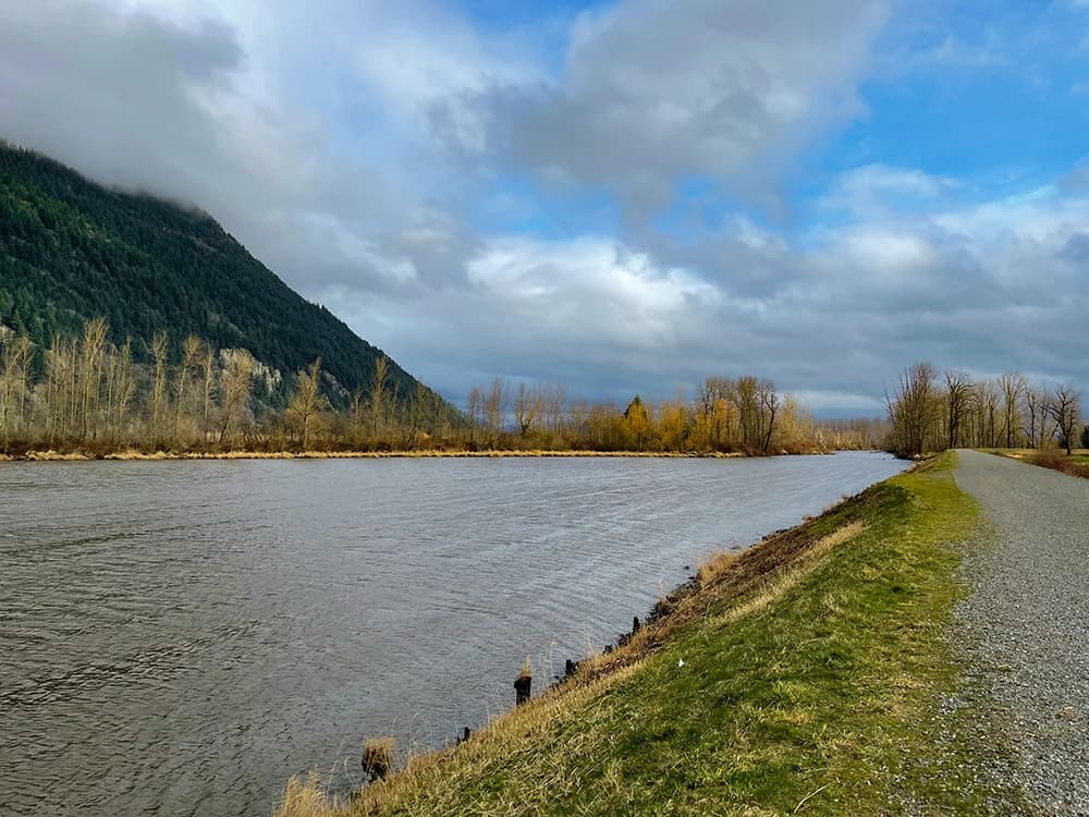
What’s happening in the Sumas River flood risk
Cross-Border flood dynamics
The Sumas Prairie’s vulnerability is intrinsically cross-border. When the Nooksack River overflows in Whatcom County, floodwaters can surge north into the Sumas Prairie, threatening farms, roads, and critical infrastructure that connect the region to the rest of British Columbia and Canada. This transboundary character has driven the collaborative framework known as the Nooksack and Sumas Watershed Transboundary Flood Initiative (TFI), which unites First Nations, provincial authorities, and municipal partners to identify measures that work across borders. The TFI structure emphasizes shared data, joint modeling, and coordinated decision-making—a structural shift for how flood risk is managed in this region. (www2.gov.bc.ca)
Key statistics and funding signals
- The Sumas River and Canal project shows a total budget of about $19 million, reflecting early-stage risk reduction work, channel improvements, and habitat considerations as part of the broader mitigation effort. This figure is part of a suite of BC initiatives designed to inform design options and prioritization. (www2.gov.bc.ca)

- In late 2025, the Province announced a targeted $3.3 million allocation to advance critical design and assessment work for Sumas Prairie flood mitigation, moving toward structural and ecological restoration measures that bolster safety and regional resilience. This funding is part of a broader $220 million in recovery, preparedness, and mitigation support since 2021 for Abbotsford and the Sumas Prairie region. The announcements emphasize a multiyear plan that builds on prior investments in infrastructure and flood defense. (news.gov.bc.ca)
- Historic flood events in the Abbotsford area—most notably the 1990, 2021, and the 2025 floods—underscore why the current momentum matters. These events highlighted how quickly cross-border surges can overwhelm pump capacity and dike systems, reinforcing the need for upgraded flood defenses and improved emergency response. (abbotsford.ca)
- There is broader context in the regional funding mix: upgrades to critical components such as the Barrowtown pump station and upstream water-supply resilience have received tens of millions of dollars in related funding, illustrating the scale and ambition of near-term improvements as part of the Sumas flood mitigation program. For example, $76.6 million has been directed to Barrowtown pump station upgrades, and $62 million to a new Abbotsford water-treatment solution, alongside other flood-related investments. (news.gov.bc.ca)
Real-world examples and implications Two concrete case studies illuminate the trend. First, the Fraser River Bank Erosion Protection project—though not limited to the Sumas River system—exemplifies how cross-jurisdiction collaboration can combine engineering, environmental restoration, and Indigenous knowledge to deliver resilience gains. The project, funded jointly by federal and provincial authorities and the City of Abbotsford, reinforces the multiplier effect of aligned governance on flood protection, habitat restoration, and infrastructure hardening. This set of collaborative practices informs the Sumas River flood mitigation BC 2026 program as it moves from design to implementation. (abbotsford.ca)
Second, Abbotsford’s flood-response narrative highlights the 2025 events and the ongoing effort to translate emergency response into durable infrastructure investments. The city’s flood-response page notes that Sumas Prairie sits atop a historically flood-prone landscape, and it emphasizes the cross-border overflow risk and the critical nature of pumping and diking infrastructure in maintaining regional economic activity and food supply. This real-world experience shapes the risk calculus driving 2026 planning and funding decisions. (abbotsford.ca)
Stakeholders affected
- Indigenous communities (Semá:th, Máthxwi, Leq’á:mel First Nations) are integral partners in the Sumas River flood mitigation journey, reflected in the joint governance and planning framework. The collaboration underscores Indigenous knowledge integration and co-management approaches that influence design, environmental stewardship, and cultural restoration within flood-affected zones. (news.gov.bc.ca)
- Municipal authorities, notably the City of Abbotsford and the City of Chilliwack, are central to on-the-ground implementation, permitting, and local adaptation of regional strategies. Provincial leadership has framed Sumas River flood mitigation BC 2026 as a multi-party effort with shared funding and accountability. (news.gov.bc.ca)
- The cross-border community—encompassing Whatcom County in the United States and BC’s Sumas Prairie—depends on coordinated planning to protect transportation corridors, energy infrastructure, and agricultural sectors that underpin provincial and national food security. The Transboundary Flood Initiative explicitly recognizes this shared risk, and the planning work ongoing in 2025–2026 aims to harmonize cross-border solutions. (www2.gov.bc.ca)
Section 2: Why this is happening
Climate drivers and risk amplification
Climate-change-driven shifts in precipitation patterns and extreme weather events have elevated the frequency and intensity of atmospheric river events that impact the Fraser Valley region. The 2021 events and the 2025 floods illustrate how heavy rainfall, rapid snowmelt, and cross-border water surges converge to overwhelm existing defenses. The BC government’s emphasis on integrating Indigenous knowledge, modern hydrological modeling, and ecological restoration into flood mitigation plans reflects a systemic approach to adapt to changing climate risk. These dynamics underpin the urgency behind the Sumas River flood mitigation BC 2026 efforts. (news.gov.bc.ca)
Funding dynamics and policy design
Funding approaches have evolved from ad hoc emergency responses to more structured, multi-year investments designed to reduce risk and bolster resilience. The province’s collaboration with First Nations and municipalities under the Sumas River flood mitigation planning framework signals a shift toward formalized governance and staged design work. The immediate funding around critical design and assessment (3.3 million) and the larger recovery/mitigation envelope (roughly $220 million since 2021) show a trajectory from immediate relief to long-term protection and habitat restoration. This funding architecture shapes project sequencing, procurement, and risk-sharing among partners. (news.gov.bc.ca)

Transboundary coordination and governance
Cross-border risk management has historically been complicated by jurisdictional boundaries and differing regulatory regimes. The Nooksack and Sumas Watershed Transboundary Flood Initiative (TFI) reframes flood risk as a shared problem requiring joint analysis and decision-making. The TFI’s governance structure—bringing together First Nations, provincial agencies, and local governments—aims to synchronize modeling, risk assessments, and implementation plans so that solutions deliver benefits on both sides of the border. This framework is central to how BC intends to realize the Sumas River flood mitigation BC 2026 objectives. (www2.gov.bc.ca)
Section 3: What it means
Business impact and market signals
The Sumas River flood mitigation BC 2026 effort carries significant implications for regional businesses, particularly in agriculture, logistics, and energy infrastructure. The Sumas Prairie holds a substantial share of BC’s dairy, poultry, and egg production, making flood resilience a matter of food security and commodity pricing stability. Upgrades to pump stations, dikes, and conveyance systems reduce operational risk for farmers, processors, and distributors, while potentially influencing insurance markets, construction demand, and public procurement trajectories. As governments commit to longer-term protection plans, businesses should monitor not only the capital costs but also the timing of project milestones and access to relief programs designed to cushion transitional disruptions. (abbotsford.ca)
Infrastructure resilience and energy security
Critical infrastructure—transmission lines, pipelines, and rail—runs through the Sumas Prairie. The enhanced flood defenses and pumping capacity directly affect electrical reliability and continuity of service for a region that serves as a food production hub and a logistics artery for Western Canada. The Barrowtown pump station upgrades and related investments demonstrate how protective infrastructure investments translate into more predictable operating environments for utilities and transport networks. This has downstream effects on project finance, contractor activity, and regional supply chains. (news.gov.bc.ca)
Regional economy and risk exposure
The broader Fraser Valley economic ecosystem—comprising farming, small businesses, and regional trade—stands to gain from a more resilient Sumas River system. Yet, the scale of planned works (ranging from tens to hundreds of millions of dollars) means districts must plan for long implementation horizons, property acquisitions in floodways, and potential land-use changes that repurpose flood-prone lands for habitat or flood storage. The recent policy discussions around Sumas River options show a spectrum of potential investments and risk tolerances, underscoring that resilience is both a public good and a market opportunity. (abbynews.com)
Section 4: Looking ahead
Near-term outlook (6–12 months)
- Design and assessment milestones: The $3.3 million allocation for critical design and assessments is expected to unlock a clearer sightline on structural concepts, hydraulic models, and ecosystem restoration packages. Expect partial publication of model results, risk assessments, and draft proposals that feed into a multi-year program. This aligns with BC’s emphasis on evidence-based planning and iterative decision-making. (news.gov.bc.ca)
- Transboundary planning progress: The Nooksack-Sumas TFI framework will likely produce more formalized agreements, shared data portals, and joint decision protocols, accelerating cross-border consensus on preferred mitigation measures and funding pathways. The TFI’s ongoing emphasis on collaborative governance suggests tangible joint actions may emerge in 2026. (www2.gov.bc.ca)
- Local government actions: Abbotsford and Chilliwack are positioned to advance projects that may include pump-station enhancements, dike improvements, and habitat-friendly flood storage; local planning remains closely tied to provincial funding announcements and approval processes. (news.gov.bc.ca)
Investment opportunities and business readiness
- Infrastructure and construction: A multi-year funding envelope creates demand for design-build contractors, engineering consultancies, and specialized flood-defense suppliers. Firms with experience in hydraulic modeling, floodplain restoration, and dike construction could see growing bid opportunities as projects move from planning to procurement. The historical cost ranges for comparable options (as seen in Abbotsford’s planning discussions) illustrate the scale of potential contracts. (abbynews.com)
- Rural economy adaptation: Agricultural operators in Sumas Prairie can benefit from early-warn systems, flood storage solutions, and habitat restoration that help safeguard crops and livestock. Public programs that support farming transitions and flood-adapted land-use could offer funding and technical assistance to farmers adapting to new flood-prevention realities. (abbotsford.ca)
- Resilience-focused innovation: The cross-border nature of the risk invites technology-enabled monitoring, early-warning analytics, and data-sharing platforms that can be commercialized or deployed through public-private partnerships. The collaborative governance model increases the likelihood of pilot programs and shared investments that accelerate market adoption of new resiliency tech. (www2.gov.bc.ca)
Comparison table: options for future flood protection scenarios Below is a concise view of the range of protection options historically discussed in Abbotsford-related planning, illustrating how costs map to resilience outcomes. Note that these figures reflect planning-era estimates and were part of prior public discussions; ongoing BC processes may refine them. The table helps contextualize 6–12 month decision windows and potential procurement scales.
| Option | Estimated Cost | Protection Level (order of magnitude) | Key Components | Public-Private Implications |
|---|---|---|---|---|
| Option 1 | ~$100 million | One-in-35-years event protection | Basic pump improvements, some dike repairs | Moderate capex; accelerates routine upgrades |
| Option 2 | ~$800 million | One-in-50 to 100-year event protection | New Sumas River pump station, dike enhancements | Large-scale construction; strong midfield contractor engagement |
| Option 3 | ~$2 billion | One-in-180-years event protection | Everything in Option 2 plus core dike reinforcements, partial land acquisitions | High capital scope; multi-year procurement, potential land use changes |
| Option 4 | ~$2.3 billion | One-in-200-years event protection | Comprehensive flood protection, rail and major infrastructure upgrades | Maximum resilience; broad economic and land-use transformation |
Sources and context supporting the table include local planning discussions and published cost ranges that illustrate the spectrum of protection levels considered for Abbotsford’s flood risk management. (abbynews.com)
Closing perspectives
Sumas River flood mitigation BC 2026 is emerging as a blueprint for cross-border resilience—part policy, part market catalyst. The combination of targeted design funding, cross-jurisdictional governance, and ongoing infrastructure upgrades signals a deliberate shift from reactive flood response to proactive risk reduction. For stakeholders in the Sumas Prairie region, this means greater clarity on project timelines, more predictable funding streams, and a stronger platform for integrating habitat restoration with flood protection. The data-driven approach—underpinned by hydraulic modeling, ecological assessments, and stakeholder collaboration—positions the region to translate risk disclosure into funded action that protects farmers, communities, and critical supply chains.
As this process unfolds through 2026, readers should watch for the release of refined hydraulic models, formalized transboundary agreements, and procurement packages tied to Barrowtown and adjacent conveyance improvements. The momentum is real: a blend of provincial leadership, First Nations partnership, and municipal coordination is driving a now-credible pathway toward enhanced flood resilience and economic stability for the Sumas Prairie and greater BC corridor. The accurate, data-informed trajectory will shape how businesses plan, insurers assess risk, and communities recover from flood events in the years ahead. (news.gov.bc.ca)