News
AI-Guided Wildlife Corridors Move From Concept to Construction
Explore a data-driven analysis of AI-Driven Wildlife Corridors in BC and Washington, transforming conservation efforts and influencing policy decisions.
By Joanna Flett · August 1, 2026 · 12 min read
 By Joanna Flett · August 1, 2026 · 12 min read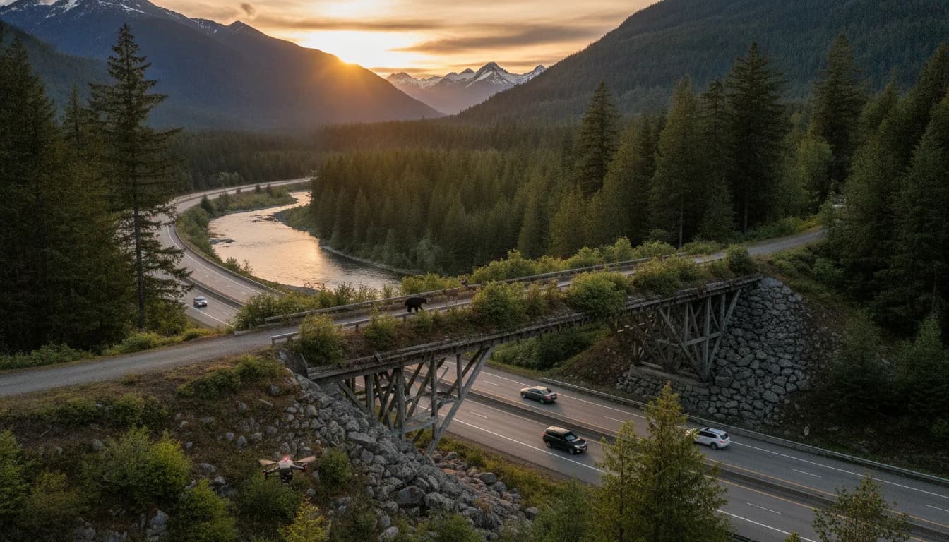
The Pacific Northwest is witnessing a tectonic shift in how wildlife movement is planned, monitored, and funded. AI-Driven Wildlife Corridors Across BC and Washington are moving from concept to concrete projects that connect species across major barriers, from cross-border parks to high-traffic highways. In British Columbia and Washington state, governments, Indigenous nations, and nonprofit partners are aligning on data-driven approaches to map movement corridors, design crossings, and monitor outcomes. This is not a theoretical exercise; recent milestones show real, on-the-ground progress that aims to improve safety for people and wildlife alike while supporting ecological resilience in an era of rapid thinking about climate and land-use change. (news.gov.bc.ca)
Across the region, the push to sustain connectivity for wildlife is being amplified by coordinated planning efforts, cross-border collaboration, and increasingly rigorous monitoring. Washington’s broader work on habitat connectivity and a state-led action plan are curbing fragmentation and prioritizing high-value linkages that cross highways and human development. Meanwhile, British Columbia’s transboundary initiatives—embodied by the Reconnecting the Rockies project and key wildlife crossings along Highway 3—are pursuing multi-phased fencing and crossing structures designed with wildlife behavior in mind. Taken together, these developments reflect a growing recognition that AI-enabled data synthesis and monitoring tools can sharpen decision-making and accelerate action on the ground. (wdfw.wa.gov)
The BC Times will continue tracking how AI-Driven Wildlife Corridors Across BC and Washington unfold, with updates on milestones, funding, policy shifts, and community perspectives. As these corridors expand, the questions for readers focus on how and when projects will reduce wildlife-vehicle conflicts, support population connectivity, and unlock tourism and economic opportunities tied to healthier ecosystems. This coverage emphasizes data, timelines, and neutral analysis to help readers understand both the promise and the constraints of large-scale corridor initiatives.
What Happened
Two nine-mile I-5 linkage zones identified as critical corridors
Two sections of Interstate 5 between Olympia and Vancouver bisect essential wildlife connections, forming what Washington officials describe as the Northern Linkage Zone and the Southern Linkage Zone. Each of these linkage zones runs about nine miles and traverses six-lane traffic that carries tens of thousands of vehicles per day. The corridor is a hotspot for wildlife-vehicle interactions and serves as a primary barrier to movement for cougar, elk, deer, and other species. Consultants are conducting a feasibility study that blends biological data with engineering opportunities to identify the best locations for wildlife crossings and associated fencing. The goal is to produce conceptual designs and cost estimates that can secure funding for long-term corridor improvements. (wsdot.wa.gov)
The Washington work on I-5 is part of a broader, data-driven emphasis on habitat connectivity in the state. Washington’s approach involves prioritizing critical terrestrial connectivity areas and coordinating with transportation agencies to mitigate barrier effects. The ongoing planning process is informed by cross-disciplinary input that includes state agencies, tribal and local governments, and academic partners. The evolving framework underscores a shared objective: ensure wildlife can move across landscapes in ways that support ecological and public safety. (wdfw.wa.gov)
Snoqualmie Pass East and I-90 crossings illustrate ongoing implementation
Washington’s Snoqualmie Pass East Project has become a benchmark for how highway improvements can advance ecological connectivity. The project has deployed more than 20 large wildlife crossing structures and extensive fencing across a 15-mile segment of I-90, with early monitoring showing significant wildlife use and reductions in wildlife-vehicle collisions where crossings exist. By late 2022, the Snoqualmie Pass East Project had already recorded substantial wildlife crossings across cameras, and ongoing monitoring continues to document a wide range of species benefiting from the crossing network, including elk, deer, coyotes, bears, and small mammals, along with amphibians and fish in some locations. This effort demonstrates how data-driven design and long-term monitoring can translate into real-world connectivity gains. (wsdot.wa.gov)
Reconnecting the Rockies: BC’s phased, fence-and-crossing strategy along Highway 3
British Columbia’s Reconnecting the Rockies: BC initiative represents a major, cross-ecosystem push to stitch connected habitat across Highway 3 and adjacent landscapes. Phase 1, conducted east of Sparwood in the East Kootenays, included roughly four kilometres of fencing designed to channel wildlife toward future underpasses. The project targets high-collision locations with wildlife connectivity in mind, and officials project that similar fence-and-crossing strategies can substantially reduce wildlife-vehicle collisions. The six-phase plan contemplates a sequence of underpasses and overpasses connected by fencing, which is designed with wildlife tracking data and historical collision patterns to guide siting. Construction for Phase 1 began in late August 2022, with completion anticipated in early fall of that year; subsequent phases build out a continental-scale connectivity network across the Elk Valley and beyond. (news.gov.bc.ca)
The broader RTR program emphasizes cross-border learning and shared standards for wildlife crossings, with collaboration among provincial ministries, Parks Canada, Indigenous nations, and environmental organizations. The provincial government has highlighted wildlife corridors as a central theme within the Together for Wildlife Strategy, reflecting a coordinated approach to reducing wildlife mortality and promoting safe road travel. The Radium area has become a focal point for seeing tangible benefits from crossing infrastructure, including sustained wildlife movement and safety improvements for local communities. (news.gov.bc.ca)
Transboundary planning signals and cross-border projects
Beyond individual crossing sites, policy and funding structures signal a growing commitment to wildlife connectivity across borders. Washington and British Columbia are collectively exploring and funding corridors that straddle the U.S.–Canada boundary, with joint efforts highlighted in transboundary corridor discussions and reports. In the United States, legislation and planning documents outline the creation of dedicated wildlife corridors accounts and crossing accounts to fund mitigation and crossing structures, with annual reporting requirements to ensure accountability and progress toward connectivity goals. While the precise mechanisms vary by jurisdiction, the shared objective remains clear: connect fragmented landscapes to sustain wildlife populations and improve safety for people traveling through these regions. (app.leg.wa.gov)
Cross-border data collaborations and modeling watch lists
Across the region, agencies and nonprofits are turning to data-driven methods to map corridors and predict habitat use under changing conditions. Washington’s WHCWG (Washington Wildlife Habitat Connectivity Working Group) has contributed to a statewide knowledge base that informs the Washington Habitat Connectivity Action Plan, including the relationship between habitat cores, working landscapes, and fracture zones created by roads and other development. These data-informed efforts are complemented by cross-border datasets and research that quantify connectivity across Washington, British Columbia, and adjacent landscapes. The result is a more integrated, science-based approach to corridor planning that takes account of both wildlife needs and human land-use pressures. (wdfw.wa.gov)
Blockquotes and direct quotes from official sources have highlighted the value of connectivity: the I-5 linkage work notes the crossing opportunities, while the RTR program emphasizes the need to reconnect habitats to support species like grizzly bears and elk across the landscape. These statements reflect a consensus that connectivity is essential to sustaining wildlife populations and adapting to climate-driven range shifts. The cross-border emphasis is particularly important in the Cascades–Rockies–Coast ranges, where wildlife needs often cross provincial and national boundaries. (wsdot.wa.gov)
Why the Breakthrough Matters: a data-driven perspective
The core idea behind AI-Driven Wildlife Corridors Across BC and Washington is to improve decision-making with better data, better models, and better monitoring. In practice, this means combining camera-trap data, genetic studies, remote-sensing, and digital models to identify where corridors should be strengthened, where crossing structures should be placed, and how corridors should be managed over time. Washington’s and British Columbia’s programs demonstrate a systemic shift from ad hoc crossing projects to strategically prioritized, science-led investment that targets the most impactful linkages. The practical upshots include safer roadways, healthier wildlife populations, and more resilient ecosystems in a rapidly changing climate. (wdfw.wa.gov)
As researchers and agencies refine corridor siting, the integration of AI-enabled analytics—while not always labeled explicitly as such in every agency document—appears in the spirit of modern wildlife management: using machine-assisted data synthesis to interpret camera data, track animal movements, and forecast corridor use under scenarios of urban growth and climate change. The broader literature and current pilot projects in the Pacific Northwest show a trend toward these kinds of tools, even as the primary public communications focus on habitat connectivity, crossing structures, and road safety. For readers, this signals a future in which decisions about corridor investments are increasingly guided by quantitative, up-to-date insights rather than purely qualitative assessments. (arxiv.org)
Why It Matters
Wildlife resilience and safety benefits
Connectivity is central to the resilience of wide-ranging species in the Pacific Northwest. The I-5 linkage zones in Washington illustrate how even relatively short highway barriers can bisect populations and create genetic isolation if left unaddressed. The data show that the zones are critical for multiple species and that engineering solutions—crossings combined with fencing—are essential to reverse fragmentation. The I-5 corridor example also highlights the need for a robust feasibility process, given the scale and cost of crossing structures, but also demonstrates that such investments are feasible with cross-agency collaboration and dedicated funding streams. (wsdot.wa.gov)
In the Snoqualmie Pass East corridor, the combination of crossing structures and fencing has become a model for how infrastructure projects can deliver ecological and safety benefits. The project’s early results—thousands of animal crossings recorded and substantial reductions in collisions within completed areas—underscore the value of investing in multi-species crossing networks. The project’s ongoing monitoring provides a template for evaluating corridor performance over time and adjusting designs as wildlife needs evolve. (wsdot.wa.gov)
Cross-border economic and ecological implications
From an ecotourism and outdoor-recreation perspective, well-connected wildlife corridors can enhance regional appeal by preserving wildlife populations and enabling safer, more enjoyable experiences for visitors and residents. Cross-border plans—such as the RTR initiative in southeastern British Columbia and the Cascades-to-Rockies collaborations—signal a broader regional strategy to maintain ecological integrity while supporting local economies that depend on healthy landscapes. In Canada’s Radium area, the Radium wildlife overpass—completed in 2025 and celebrated in 2026 press materials—has become a landmark example of how targeted investments in crossings can reduce collisions, protect habitat, and contribute to safer travel for communities. The overpass’s width (34 metres) and its integration with fencing exemplify design choices aimed at maximizing use by a wide range of species. The public communications around this project also emphasize community engagement and cross-stakeholder collaboration as keys to success. (news.gov.bc.ca)
Policy and funding signals shaping the landscape
Policy developments in Washington and British Columbia reveal a shared understanding that corridor investments require durable funding and transparent accountability. Washington’s Move toward a dedicated wildlife corridors account and associated crossing account—paired with reporting requirements to demonstrate progress—signals a longer-term commitment to connecting habitats in a governance framework that recognizes the budgetary realities of large-scale infrastructure with ecological goals. In British Columbia, provincial and federal partners, Parks Canada, Indigenous groups, and environmental organizations are aligning funding and governance around crossing projects, corridor fencing, and monitoring programs. These partnerships are critical for sustaining momentum through political cycles and procurement processes. (app.leg.wa.gov)
Lessons from the region and beyond
Experts studying connectivity in the North Cascades ecosystem emphasize the importance of cross-border collaboration, with climate change intensifying the need to keep wildlife ranges connected across provincial and national boundaries. Recent research and government reports stress that healthy corridors depend on a mix of large protected areas, functional linkage zones, and carefully planned infrastructure that minimizes barriers. The Pacific Northwest experience—combining high-profile crossing projects with data-driven siting and monitoring—offers a blueprint for other regions facing similar fragmentation challenges. The cross-border orientation of programs like RTR and the Washington–British Columbia collaborations demonstrates how shared ecological futures can align with shared policy goals. (pubs.usgs.gov)
What’s Next
Schedule and next steps in Washington
Looking ahead, Washington’s connectivity planning continues to move from planning to implementation, with ongoing work under the Washington Habitat Connectivity Action Plan. The plan prioritizes high-value linkages, supports coordination among agencies, and seeks to integrate road-barrier mitigation with broader landscape-scale conservation. A notable procedural component is the statutory reporting requirement for the newly authorized wildlife corridors and crossings accounts, which directs agencies to report on expenditures and progress to the Legislature and Governor’s Office by December 1, 2026, and every two years thereafter, assuming funds are appropriated. This framework helps ensure accountability and maintain public support for corridor investments as climate and development pressures evolve. (wdfw.wa.gov)
Phased corridor expansion in British Columbia
British Columbia’s Reconnecting the Rockies program continues to advance across Highway 3 with a phased approach that blends fencing, underpasses, and overpasses to create a continuous network for wildlife movement. Phase 1 has already demonstrated the efficacy of fencing to guide animals toward crossing structures, with early results indicating a potential for substantial collision reductions when combined with crossing infrastructure. The six-phase plan envisions a broader corridor network linking key habitats across the Elk Valley and adjacent landscapes, anchored by data on collision hotspots, wildlife presence, and land-use patterns. The provincial government continues to coordinate with Parks Canada, Indigenous communities, and local partners to secure funding and align project timing with other transportation and land-management priorities. (news.gov.bc.ca)
Monitoring, AI-enabled insights, and public engagement
As corridor networks grow, monitoring will be essential to assess effectiveness and guide adaptive management. AI-enabled tools—ranging from advanced acoustic and image analytics to multimodal data fusion—are increasingly part of wildlife monitoring and habitat assessment in other contexts, offering the prospect of more timely and precise insights into corridor use and species responses. While some examples come from adjacent domains (such as acoustic AI for owl detection or wildlife-tracking projects described in national and international outlets), the underlying logic remains consistent: richer data and better models enable faster learning and better decision-making about where to invest crossing infrastructure and how to manage landscapes for long-term connectivity. These developments will likely influence corridor planning in both WA and BC, alongside traditional methods like camera networks, field surveys, and community reporting. (axios.com)
A look at cross-border collaboration and potential milestones
The cross-border dimension of AI-Driven Wildlife Corridors Across BC and Washington remains a central feature of regional planning. Canada’s Parks Canada and provincial agencies have long supported relational approaches to ecological corridors, including the Coast–Cascades initiatives and transboundary connectivity projects in the Elk Valley and Columbia wetlands areas. Washington and BC officials continue to explore formalized information-sharing protocols, shared data repositories, and joint monitoring programs that could accelerate learning and funding alignment across borders. The Radium overpass in BC and the Highway 3 corridor in BC are concrete examples showing how cross-border collaboration can yield tangible results, while US–Canada coordination continues to evolve through policy discussions, cross-border EIA frameworks, and harmonized monitoring commitments. (news.gov.bc.ca)
Closing
The Pacific Northwest’s AI-Driven Wildlife Corridors Across BC and Washington reflect a broader shift toward data-informed, cross-jurisdictional conservation. From the I-5 linkage zones in Washington to the RTR crossings in southeastern British Columbia, the region is building a connected network designed to keep wildlife mobile while safeguarding road users. The work is ongoing, and the timelines are measured, but the early milestones—new fencing, successful crossings, and cross-border policy signals—illustrate a public commitment to resilient landscapes and safer communities. For readers, the key takeaway is clear: when data informs decisions, corridor investments become more targeted, more effective, and more capable of withstanding the pressures of climate change, urban growth, and evolving public priorities. As these initiatives mature, BC Times will continue reporting on milestones, funding decisions, and the practical impacts on wildlife and people across the border.